Create a ggalluvial plot in R

Author

Dr. Joscelin Rocha-Hidalgo

Published

May 28, 2023

Buy me a coffeeBuy me a coffee


By SAROJ

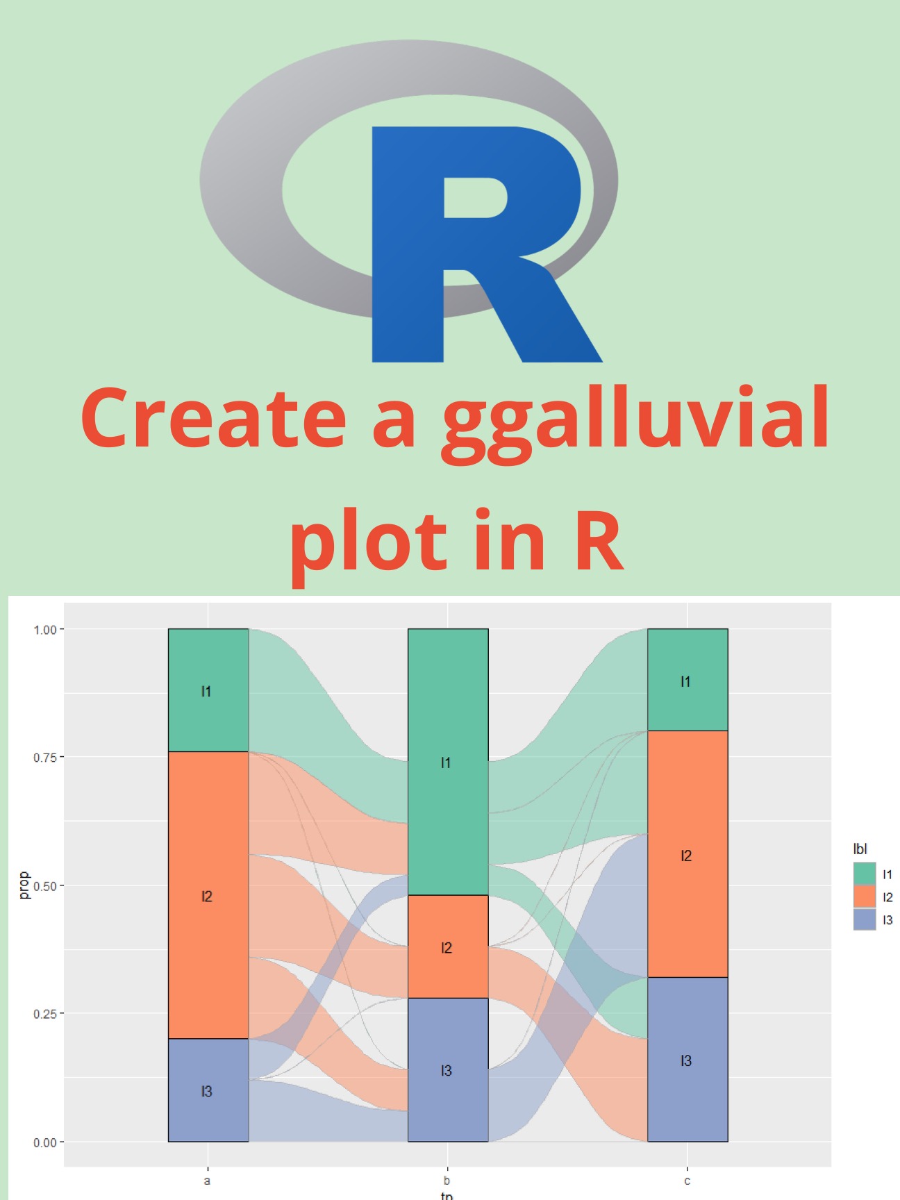
Excerpt from blog: A ggalluvial plot, also known as an alluvial diagram, is a type of visualization used to show how categorical data is distributed among different groups. It is particularly useful for visualizing how categorical variables are related to each other across different levels of a grouping variable.

  1. Link to blog here: https://pyoflife.com/create-a-ggalluvial-plot-in-r/

Graphic showing how to create a ggaluvial plot in R. The top half displays the R logo with the text "Create a ggaluvial plot in R." The bottom half features a ggaluvial plot with three vertical blocks labeled a, b, and c, each split into stacked segments (l1, l2, l3) connected by flowing colored ribbons that represent transitions in proportions between categories.

Back to top